Note: this page is only a draft, but this project is hosted on a public repository where anyone can contribute. Learn how to contribute in less than a minute.
ArcGIS QuickCapture
ArcGIS QuickCapture is the fastest way to collect field observations. With this app, you can quickly record field observations from a moving vehicle while you scout locations, conduct aerial surveys, or assess damage. Send data back to the office for analysis in real time and eliminate time spent manually processing handwritten notes
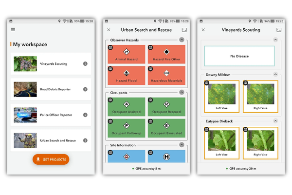
Table of contents
Introduction
Learn more at: esri.com/en-us/arcgis/products/arcgis-quickcapture
Additional resources
Probably not all the resources are in this list, please use the ArcGIS Search tool looking for: "ArcGIS QuickCapture".
Related products or technologies
List of all Esri products in the "Esri Products - ArcGIS Platform" group
Other related list of resources
Contributions
Feel free to improve/extend this resource page using this template (Contribution Guide).